Ministerio Agua de Vida
Two Projects on the Rio Bocay
Communities of Kayaskita and Sala de Dios
Jinotega, Nicaragua
Sponsored by: Sharon and Steve Harrison, Sugar Hill, GA
|
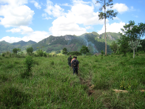
Ed has been helping Ronnie Hopkins, our fellow missionary in Nicaragua, with water projects on the Rio Bicay for several years. In January we returned to the River to check out two more projects; Kayaskita Community and Sala de Dios Community. We had funded a small effort to bring water to the Kayaskita School, but this is a larger project for the entire community. Both communities are located below limestone outcroppings in the mountains above which have abundant springs. The goal of the trip was to assess these two projects and to start teaching the Nicaraguans to use the GPS. |
|
|
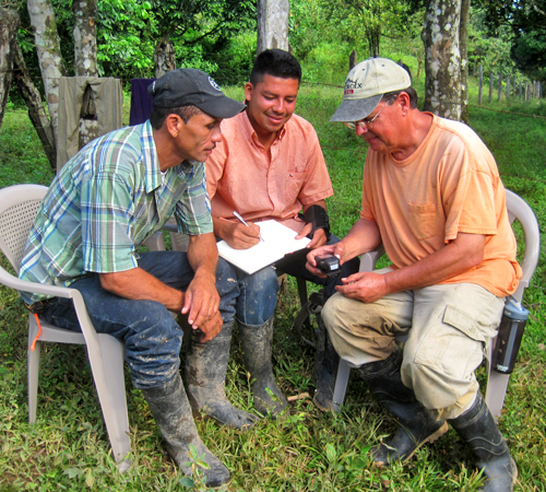
Giving the guys a GPS lesson |
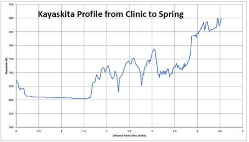
Elevation Profile from the Clinic to the Spring |
|
We use a hand held Garmin eTrex Model 30 to map out the pipeline routes.
The main advantage to this
unit is that it provides altimeter corrected elevation - a real plus in tracking profiles for
piping design. We can usually get closure of an elevation loop to within 10 ft., good enough
for situations where the elevation profile from the spring to the village drops for 100's of feet.
Above is Ed giving a GPS lesson to Nelson and Freddie, and the STEEP Kayaskita elevation profile.
|
|
|
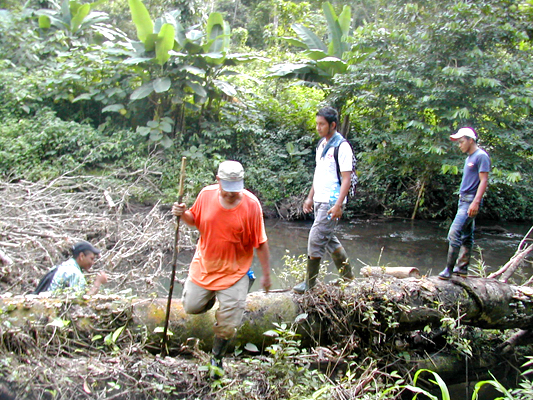
Log creek crossing on the trail to the Kayaskita spring |
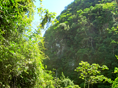
Limestone outcroppings where the spring is |
|
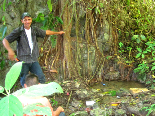
The spring for the Community of Sala de Dios (which means "God's living room") is also located far from the village. The pipeline route will be across a wide swampy area which will require trenching in the dry season. The spring appears to be plentiful, however. |
|
|
Beautiful scenery on the hike to the Sala de Dios spring |
Freddie the construction foreman at the Sala de Dios spring |
|
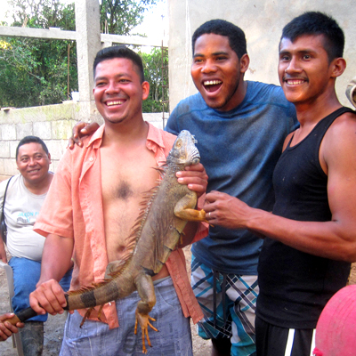
The base camp was at a clinic and health care worker training center near the river. Ronnie is working hard to complete this facility to house doctors, nurses and trainers from the US and from the Nicaraguan Health Department. One afternnon there was a lot of shouting and laughing along with cracks from a 22 rifle. Ed went outside to find that the guys had gotten a couple of iguana lizards (locally called garrobos). The guys cooked them up in a soup, along with some vegetables, in a big 5 gallon pot. It was delicious - and no - the iguana does not taste like chicken! |
|
|
A happy bunch of Nicas! |
YUMMMMMMMMMMMMMMMMM! |
|
There is a lot of design work left to do on these two projects, and the funds have to be raised for construction. But the church members in these two communities are faithful, hard working folks. Please pray that these projects will move ahead and to God be the Glory! |
|
Technical Details Project date: Assessment Jan 7-10, 2016 - Project Ongoing Kayaskita Clinic Location: Latitude - N 13° 55 47.9 Longitude - W 85° 22 18.9 Kayaskita Spring Location: Latitude - N 13° 56 30.6 Longitude - W 85° 20 9.4 Distance from Kayaskita Clinic to Spring: 4.5 miles Kayaskita Clinic Elevation: 670 ft. above sea level Kayaskita Spring Elevation: 899 ft. above sea level Project Cost: Unknown - design ongoing Type of project: Installation of spring water collection and distribution system People served: Unknown - design ongoing Sala de Dios Community Location: Latitude - N 13° 56 41.6 Longitude - W 85° 21 51.3 Sala de Dios Spring Location: Latitude - N 13° 57 31.6 Longitude - W 85° 23 14.7 Distance from Sala de Dios Community to Spring: 2.4 miles. Sala de Dios Community Elevation: 500 ft. above sea level Sala de Dios Spring Elevation: 1,137 ft. above sea level Project Cost: $17,550 (preliminary estimate) Type of project: Installation of spring water collection and distribution system People served: Estimated to be about 50 families |
|

|
|
Email us
Or snail mail us at: TMS Global 6234 Crooked Creek Rd. Norcross, GA 30092 |